Albuquerque’s complex Rio Grande rift geology, with interbedded alluvial sands, gravels, and clay lenses, demands geophysical methods that resolve stratigraphy without the ambiguity of sparse borings alone. Near-surface shear‑wave velocity profiling through MASW / Vs30 directly supports IBC site classification and the City of Albuquerque’s grading requirements, while HVSR microtremor survey rapidly identifies impedance contrasts and fundamental site periods in tight urban lots where active sources are constrained.
These techniques are routinely specified for critical infrastructure, mid‑rise foundations, and seismic retrofit designs across Bernalillo County. On larger corridor studies or when mapping depth‑to‑bedrock and groundwater, we pair velocity data with electrical resistivity / VES to delineate lithologic boundaries and saturation zones, reducing subsurface risk before excavation or deep foundation installation.
Geophysics in Albuquerque provides a non-invasive means of characterizing subsurface conditions across the Rio Grande Rift, where complex basin-fill sediments, fluvial deposits, and shallow groundwater demand precise investigation. Local geology is defined by unconsolidated sands and gravels of the Santa Fe Group, interbedded with clays and silts, often concealing buried stream channels and variable bedrock depths. Our geophysical surveys integrate seamlessly with direct methods like the SPT (Standard Penetration Test) and In-Situ Testing, delivering continuous subsurface profiles that adhere to ASTM D6429 for surface geophysical methods and relevant New Mexico Environment Department guidelines.
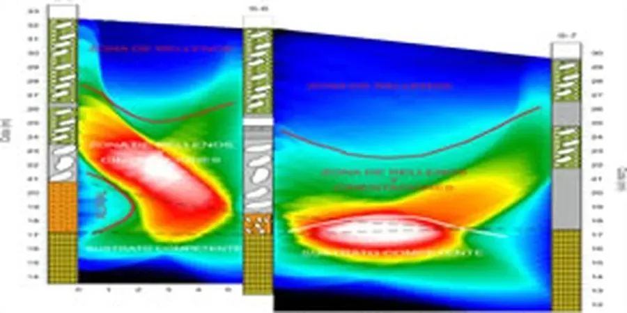
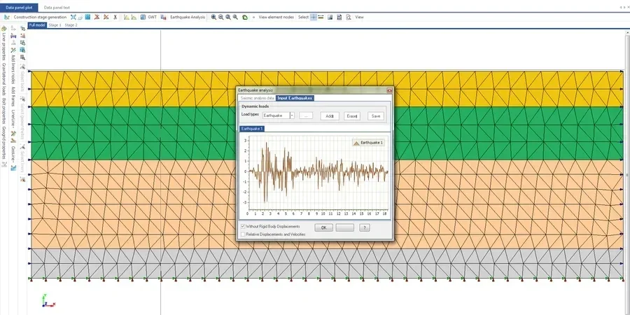
Methodology relies on established USA standards to ensure repeatability and regulatory acceptance. We deploy Electrical Resistivity Imaging (ERI) following ASTM D6431 to map lithologic boundaries and groundwater tables, while Multichannel Analysis of Surface Waves (MASW) per ASTM D5777 measures shear-wave velocity for seismic site classification. Ground Penetrating Radar (GPR) surveys conforming to ASTM D6432 locate utilities, voids, and shallow stratigraphic contrasts essential before exploratory test pit excavation. When target depths exceed 30 meters, seismic refraction and reflection methods are calibrated with Flat Dilatometer Test (DMT) data to constrain modulus values and detect fault zones.
Albuquerque projects routinely benefit from geophysical pre-characterization. For commercial developments on the West Mesa, ERI and MASW delineate expansive clay layers and collapse-prone silts before designing foundations that reference Plate load test (PLT) bearing capacity verification. Infrastructure corridors crossing the valley margin use seismic surveys to map the Sandia fault and assess liquefaction potential, while environmental site assessments combine electromagnetic profiling with direct soil sampling to track contaminant plumes without unnecessary drilling. These integrated approaches reduce geotechnical uncertainty in a region where subsurface heterogeneity can shift dramatically within a single building footprint.
Field acquisition is executed with calibrated instruments, and data processing yields 2D cross-sections or 3D models showing target anomalies, velocity gradients, and interpreted geologic contacts. Deliverables include color-scaled resistivity profiles, shear-wave velocity transects, and annotated radargrams correlated with available boring logs or field density test (sand cone method) results. By bridging the gap between sparse borings and continuous subsurface imaging, our geophysical services reduce the number of intrusive tests required, lower overall site investigation costs, and provide the detailed stratigraphic framework Albuquerque’s challenging geology demands for safe and efficient design.